Articles

Trade Corridor Efficiency Benchmarking (2023–2024

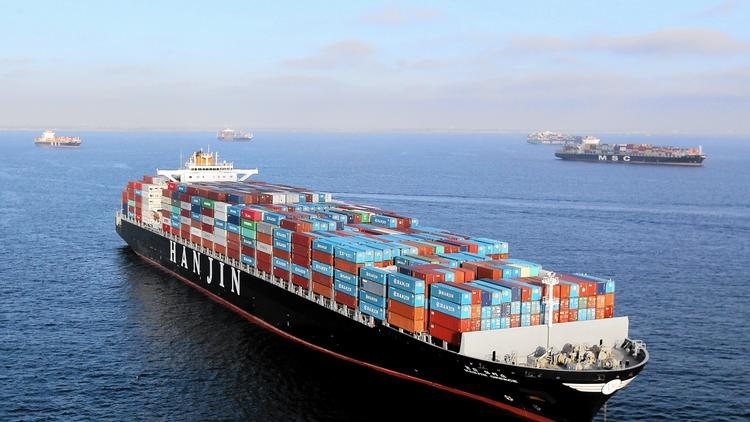
Executive Overview Ghana’s role as a regional trade facilitator hinges on the performance of its two primary corridors: Tema–Ouagadougou and Takoradi–Abidjan. This benchmarking report evaluates both routes across key metrics including transit time, cost efficiency, infrastructure quality, and customs coordination. Between 2023 and 2024, the Tema–Ouagadougou corridor maintained its dominance in cargo volume and reliability, while Takoradi–Abidjan showed notable improvements in cross-border processing and road upgrades. The Tema–Ouagadougou corridor, which serves landlocked Burkina Faso, recorded an average transit time of 6.2 days for containerized cargo, with clearance delays concentrated around Paga and Hamile border posts. Despite its higher throughput, the corridor faces challenges with road congestion near Accra and inconsistent weighbridge enforcement. However, recent investments in the Eastern Corridor Road and the expansion of inland container depots have helped reduce bottlenecks and improve cargo tracking. In contrast, the Takoradi–Abidjan corridor, though historically underutilized, saw a 22% increase in cargo movement during the review period. This growth is attributed to improved road surfacing along the Elubo–Axim stretch and enhanced customs interoperability with Côte d’Ivoire. Average transit time dropped to 5.4 days, making it a competitive alternative for shippers seeking faster turnaround and lower congestion risk. The corridor also benefits from proximity to emerging industrial zones in the Western Region, which are increasingly integrated into regional supply chains. Cost benchmarking revealed that Tema–Ouagadougou remains slightly more expensive per ton-kilometer due to higher port handling fees and inland transport charges. However, its reliability and digital tracking systems offer greater predictability for high-value cargo. Takoradi–Abidjan, while cheaper, still faces gaps in digital documentation and last-mile logistics, particularly for perishable goods. The report recommends harmonized corridor policies under ECOWAS protocols, expanded use of electronic transit systems, and targeted investment in border infrastructure. It also calls for public-private partnerships to scale inland logistics hubs and improve driver training and safety compliance. In summary, Ghana’s trade corridors are evolving into strategic arteries for West African commerce. While Tema–Ouagadougou leads in volume and infrastructure maturity, Takoradi–Abidjan is emerging as a viable alternative with growing efficiency and regional relevance. This benchmarking provides a data-driven foundation for corridor optimization, stakeholder coordination, and investment planning. Pie Chart for Cargo Volume Share 68% Tema–Ouagadougou 32% Takoradi–Abidjan Expert Quote from Nana Boateng, Logistics Consultant, ECOWAS Trade Observatory Corridor efficiency isn’t just about speed — it’s about predictability, interoperability, and trust across borders. Download report

Trade Corridor Efficiency Benchmarking (2023–2024 Read More »

Climate Risk Assessment for Coastal Assets

Executive Overview Ghana’s coastal infrastructure faces mounting climate risks that threaten the resilience of its maritime economy, urban settlements, and ecological zones. The Climate Risk Assessment for Coastal Assets provides a comprehensive evaluation of sea-level rise, erosion patterns, storm surge exposure, and infrastructure vulnerability across key coastal regions including Accra, Tema, Takoradi, and Ada. Drawing on satellite imagery, GIS mapping, and hydrodynamic modeling, the report identifies high-risk zones and proposes adaptation strategies to safeguard port facilities, roads, housing, and fisheries. Between 2023 and 2025, Ghana experienced a measurable increase in tidal anomalies and shoreline retreat, with erosion rates exceeding 1.5 meters per year in parts of the Volta Delta and Western Region. Port infrastructure, especially bulk terminals and access roads, showed signs of structural stress due to saltwater intrusion and foundation destabilization. The assessment highlights that over 40% of Ghana’s coastal assets are located within zones classified as “high exposure,” with Tema and Takoradi ports ranking among the most vulnerable due to their proximity to low-lying floodplains and aging drainage systems. The report also examines the socioeconomic impact of climate threats, noting that over 2 million people live within 5 kilometers of Ghana’s coastline, many of whom depend on fishing, trade, and tourism. Displacement risks, loss of livelihoods, and infrastructure damage could compound existing development challenges unless proactive measures are taken. Recommended interventions include shoreline reinforcement using eco-engineering techniques, relocation of critical assets, and integration of climate resilience into port master plans and urban zoning regulations. A key innovation in the assessment is the use of a Coastal Resilience Index, which scores each region based on exposure, adaptive capacity, and institutional readiness. Greater Accra scored moderately due to its planning frameworks and early warning systems, while the Volta Estuary and Western enclaves scored lower due to limited infrastructure and fragmented governance. The report calls for a national climate adaptation fund and inter-agency coordination to accelerate implementation of resilience measures. In summary, the Climate Risk Assessment for Coastal Assets underscores the urgency of climate-proofing Ghana’s maritime infrastructure. It offers a data-driven foundation for policy reform, investment prioritization, and community engagement. As climate volatility intensifies, Ghana’s ability to adapt will define the sustainability of its coastal economy and the safety of its shoreline communities. Population at Risk by Proximity to Coastline 40% 1 – 3km 20% 3-5km 15% More than 5km 25% Less than 1km Expert Quote from Dr. Selorm Tetteh, Coastal Engineer, Coastal Resilience Lab Coastal resilience isn’t a luxury — it’s a frontline defense for Ghana’s maritime economy and the millions who depend on it. Download report

Climate Risk Assessment for Coastal Assets Read More »

Port Community Systems: Adoption Roadmap

Executive Overview Ghana’s roadmap for adopting Port Community Systems (PCS) marks a pivotal shift toward digital integration and operational transparency across its maritime logistics chain. As global trade accelerates and regional competition intensifies, the need for a unified digital platform that connects port stakeholders — from customs and shipping agents to freight forwarders and terminal operators — has become increasingly urgent. The PCS initiative, spearheaded by the Ministry of Transport in collaboration with UNCTAD and the Ghana Ports and Harbours Authority, aims to streamline cargo handling, reduce clearance times, and improve data visibility across Tema and Takoradi ports. The roadmap outlines a phased implementation strategy beginning with stakeholder mapping and needs assessment, followed by system architecture design and pilot deployment. Phase I, completed in late 2023, identified over 40 active stakeholder groups and revealed critical gaps in data interoperability, document standardization, and real-time tracking. Phase II, launched in early 2024, focused on building a modular PCS framework capable of integrating customs declarations, vessel scheduling, gate operations, and inland transit documentation. One of the most transformative aspects of the PCS rollout is its emphasis on automation and predictive analytics. By digitizing cargo manifests and synchronizing vessel arrival data with customs clearance protocols, the system is expected to reduce average dwell time by up to 35% over the next two years. Early pilot results from Tema Port show promising reductions in manual processing errors and improved coordination between shipping lines and inland transport providers. The roadmap also addresses policy harmonization and legal frameworks, recommending updates to Ghana’s maritime regulations to support electronic documentation, data privacy, and cross-border interoperability. A PCS governance board has been proposed to oversee compliance, system upgrades, and stakeholder training, ensuring that the platform evolves with industry needs. In summary, the PCS Adoption Roadmap represents a strategic leap toward smarter, more efficient port operations in Ghana. By aligning digital infrastructure with policy reform and stakeholder engagement, the initiative positions Ghana to lead regional efforts in trade facilitation and maritime innovation. The success of this roadmap will depend not only on technical execution but also on sustained collaboration across public and private sectors. Pie Chart Distribution For The Report 20% Customs Division 15% Ghana Ports & Harbor Auth 15% Freight Forwarders 12% Shipping Lines 5% Regulatory Agencies 5% Others 8% Tech Vendors (e.g., GCNet) 10% Terminal Operators 10% Logistics Providers Expert Quote from Adwoa Mensimah, Trade Facilitation Advisor, UNCTAD “Digitizing Ghana’s port ecosystem isn’t just about speed — it’s about trust, transparency, and regional competitiveness.” Download report

Port Community Systems: Adoption Roadmap Read More »

2024 Ghana Maritime Sector Performance Report

Executive Overview Ghana’s maritime sector demonstrated notable resilience and strategic growth between January and September 2024, despite persistent global headwinds including inflationary pressures, energy cost volatility, and geopolitical disruptions. The country’s two primary ports — Tema and Takoradi — recorded a combined cargo throughput increase of 5.1% compared to the same period in 2023. This growth was largely driven by a surge in export volumes, which rose by an impressive 30.7%, offsetting a 6.9% decline in imports. The export boom was anchored by strong performance in gold bullion, crude petroleum, and cocoa products, which together accounted for over 78% of total export value. Transit and transshipment trade also saw significant expansion, with volumes rising by 58.8%. This reflects Ghana’s strengthening role as a regional trade facilitator for landlocked neighbors such as Burkina Faso, Mali, and Niger. Improvements in corridor infrastructure, customs digitization, and port handling efficiency contributed to this upward trend, positioning Ghana as a competitive gateway within the ECOWAS region. Tema Port continued to lead in operational throughput, benefiting from recent automation upgrades that reduced average vessel turnaround time to 36 hours. Takoradi Port, while slightly behind at 42 hours, showed steady improvement through targeted investment in bulk handling and offshore support services. The Ghana Ports and Harbours Authority reported that private sector participation now accounts for 59% of total infrastructure investment, reflecting a shift toward public-private partnerships in port development. Shipping agents maintained stable performance across trade categories, with containerized cargo showing the highest reliability metrics. However, challenges persist in harmonizing documentation standards and improving last-mile logistics, particularly for inland transit routes. In summary, Ghana’s maritime sector in 2024 reflects a dynamic blend of growth, reform, and strategic positioning. While export strength and regional facilitation are clear highlights, the sector’s long-term competitiveness will depend on continued investment in infrastructure, digital systems, and policy alignment. This report provides a foundation for stakeholders to assess progress, identify gaps, and align future initiatives with Ghana’s broader trade and development goals. Pie Chart Distribution For The Report 55.3% Gold Bullion 17.8% Crude Petroleum Oils 8.4% Cocoa Beans & Paste 3.6% Other 6.1% Timber & Wood Exports 5.2% Aluminum & Bauxite 3.6% Fish & Seafood Expert Quote from Kwesi Aboagye, Maritime Analyst, HarborLink Analytics Ghana’s maritime sector is no longer just a gateway — it’s becoming a strategic anchor for regional trade resilience. Download report

2024 Ghana Maritime Sector Performance Report Read More »

An Overview of Biomethane in the Maritime Transportation Sector

It is estimated that sea-going vessels ( that carry 90% of the world’s trade) contribute at least 3% of all global pollution. Knowing this, the maritime transport sector has been working on adopting a more environmentally friendly fuel alternative as against traditional fossil fuel. That alternate is biomethane. Biomethane, also called liquified biogas (LBG), is a flexible and easily storable fuel that can be used wherever natural gas is used. It is produced from biogas derived from organic matter (often from landfill, food waste, or agricultural waste). When compared to a conventional petrol-fueled vessel, a biogas-powered ship reduces CO2 emissions by up to 90%. Liquified biogas represents an opportunity for the shipping industry to minimize its greenhouse gas emissions (i.e Carbon dioxide from burning fossil fuel). Biogas has a superior burning rate to natural gas. While biogas only has one flammable component (methane), natural gas contains ethane, propane, butane, and even hydrogen. These other chemicals burn under different conditions (temperature, pressure), making it more difficult to burn the fuel efficiently. As the significance of Liquefied biogas (LBG) grows, so does its potential for use in maritime shipping and transportation. Countries in the Baltic Sea Region have launched “project biogas” to investigate the feasibility of using liquified biomethane in the maritime sector and other modes of transportation by developing plans to build an LBG infrastructure ( ports, fuel stations, vehicles, etc). Shipping lines such as CMA CGM Group and A.P Moller-Maersk are committed to the energy transition and have set a goal of becoming Net Zero Carbon by 2050.  CMA CGM has ordered seven new ships powered by biogas, a technology that helps to significantly reduce greenhouse gas emissions while also protecting air quality by eliminating almost all air pollutants. The seven new container ships, which will be delivered gradually beginning in 2024, will serve Guadeloupe and Martinique, significantly increasing services to the two islands while maintaining the same service standards, reliability, and regularity.  A.P. Moller – Maersk has identified partners to produce green fuel for its first vessel to run on carbon-neutral methanol. The partners, REintegrate and European Energy will build a new Danish facility to produce the approximately 10.000 tonnes of carbon-neutral e-methanol that Maersk’s first vessel with green e-methanol capability will consume annually. Maersk will collaborate closely with REintegrate and European Energy on the facility’s development. The fuel is expected to be available in 2023. Although not all maritime ecosystem players have embraced biomethane, the product has a significant potential role and a great future in the transformation of the global maritime energy systems into green and energy-efficient ones.  

An Overview of Biomethane in the Maritime Transportation Sector Read More »

Exploring Cruise Ships

Photo credit: The Visual Dictionary of Transportation (7th April, 2018) (www.issuu.com) There are a great number of cruise ships out there. Most of them have female names. Do you know why? This is because many folktales say that the earlier seafarers named their boats with female names, usually after the women they loved. It’s a tradition that began generations ago with the sailors, and has come to stay. Cruise ships are special vessels designated to passengers for enjoying a recreational time at sea. They are mostly luxurious ships that provide lodging to passengers. I could say they are like 5-star hotels on the sea! The difference is the stunning view of nature and the refreshing breeze that blows your worries away, rejuvenating you for a long time. There a thousand and one activities that can be done on a cruise ship. It all depends on the creativity of its owners and management to make it a one-stop recreational centre when docked and at sea. One could never get enough of a thrill when there are varieties of games, water slides, zip-lining, surfing, water boarding, whirlpool swimming, pool parties, concerts, fashion shows, video games, water parks, treasure hunts, nature tours, scrubber diving, movie nights, and whatever variety you can think of! Cruise ships are of many varieties and may have different parts and functions based on the kind of entertainment and recreational services being provided. Join me as we delve in to explore some general parts. The Bow, which is the pointed part in front of the ship, serves a purpose. It has saved many a soul from drowning. It pushes away the huge waves when they hit the ship from that angle, paving way for the ship to pass through. The Port Hand is the first place a passenger lands, on board the ship. It’s spacious enough for movement and enables the unloading of passengers as well. The Forecastle is also in front of the ship. It holds all the tools needed for anchoring the ship including the bollards, and ropes. The Open Air Terrace is a much more spacious place in front of the ship, usually in front of the navigation tool. The Playing Area is an open space at the top of the ship, much like the Open-Air Terrace. This space is available for all kinds of sports and recreation. This is where water slides, open-air movie nights, book reading, and all sorts of events can take place. The Sundeck is also a recreational area for viewing the sea and relaxing in the sun. The Promenade Deck is a simple deck used for passage. Passengers walk through from the bow to the stern to other parts of the ship. The Quarter Deck, also called the back deck, is located at the back of the ship and is mostly used for administrative work by officers. From this place, information is disseminated to passengers on the ship. This is also where the ship bell is usually located. The Radio Detection and Ranging (Radar) is a detection device that helps with navigation. It detects and measures objects, including other ships, that are close to the ship which helps to prevent collisions. The Radio Antenna also known as marine VHF Radio, is a radio that enables emergency communication to other marine officers, seafarers or SAR team. The Telecommunication Antenna converts electromagnetic signals into electric signals to send information across to other seafarers. The Captain’s Quarters, as per its name, is the main abode of the Captain. This is where he rests and sleeps; his cabin. The Bow Thruster is an extra engine in the ship, used as a propulsion device and helps in moving the ship. The Compass Bridge which is mostly known to have the ‘steering wheel’, is also called the Bridge of the Ship. This steering wheel is rightly termed the Ship’s Steering Command. There are navigation tools, including a compass and other devices to help with navigating the ship. The Starboard Hand is an anchored float or a buoy, that serves as a navigation mark to show hazards or reefs in the water. This is attached to the Starboard, on the right side of the ship. The Anchor-Windlass Room contains the Windlass, also known as Anchor machine. This system is used to move the anchor and its chains. The Stem Bulb, also called the Bulbous Bow, is at the bottom front end of the ship. It helps with the tilting angle of the ship and the ship’s resistance to sea waves together with the ship’s bow. The Swimming Pool is one of the most loved recreational slots on the cruise ship. As the sea waves intrigue and thrill the cruisers, the pool gives them the opportunity to exert their excitement, especially for those with no experience swimming in the deep seas. The Stabilizer Fin, which looks much like a fish’s fin, is located on both the left and right hull of the ship. It helps balance the ship on the water. The Lounge is a more relaxed version of a hotel lounge. It is much more luxurious and comfortable inside the ship. Passengers can relax there and listen to soothing music. It also serves as a relaxing hideout, should it rain outside the ship. The Funnel is a chimney that emits smoke from the ship’s engine as it burns fuel. The Hall is a big room that is used for programs, conferences, parties and other events. Some cruise ships have a number of Halls for different purposes and with various seating capacities. The Porthole is a circular gap on the bottom side of the ship that allows lighting and ventilation in those areas. It usually has a glass window. The Lifeboat is a mini boat, always attached to the ship. Most of the big ships have about twenty to forty of them for emergencies. The lifeboats are very needful for carrying passengers and sometimes luggage off the ship when the ship is damaged or under threat. The Propeller

Exploring Cruise Ships Read More »

Cranes

CRANE FOR SHIPPING    Ever heard of a shipping crane? (Well before we get into that),shipping requires the usage of  different tools to aid it’s functionality on sea. The  shipping crane is no exception. It primarily lifts, lowers, and moves  heavy materials or objects horizontally from a point to another and is typically equipped with a hoist rope, wire ropes or chains, and sheaves. The commercial ports use different types of shipping cranes for loading and unloading containers. Here are the various types and how they are  used: CRANE ARMS Crane arms, also known as luffing cranes, are fixed structures that can move a suspended load backward or forward while keeping the suspension hook at a fixed height automatically. They are motorized cranes that are common in most ports, with a wide range of applications and where their imposing structures of up to 30 meters can be found. SIDE LIFTER The Side lifter is a multipurpose crane used to transport goods between terminals and trucks or terminal rail. It is a popular model at the port.This crane incorporates a side lift in the semi-trailer or one of the wagons with four support for remote handling or containers. TELESCOPIC CRANES Telescopic cranes are fixed structures designed for use in the marine environment and used for auxiliary tasks such as loading and unloading. They are used in maintenance tasks as well as for stacking various types of merchandise. Depending on the application of this machinery, the telescopic crane can be mounted both in the terminal itself and in various structures with a high capacity of rotation and different types and ranges. They are cranes that can be configured with Various equipment, such as the remote control for remote merchandise handling or indicators such as the safety load limit and overload on the winch, are available. SHIP-TO-SHORE CRANES Ship-to-shore cranes  commonly known as Gantry Cranes are large structures that can reach up to 140 meters in height and carry more than 20,000 tons of cargo, but they move along the dock using rails or tires. It is a specialized machinery for loading and unloading containers, with four columns and an upper cantilever.

Cranes Read More »

SHIPS / VESSELS

Minus vessels or ships a port will be useless. We know what a port is and its types, now let’s dive into what a ship or vessel is, the types and its functions. A ship is a large boat for transporting people or goods (cargo) by sea as defined by the Oxford dictionary. Vessels come in all shapes and sizes and are designed to carry a wide variety of cargoes. Below are some of the main types of ships. Dry Cargo Ships Dry cargo vessels were the backbone of the world’s merchant fleet. Known as general cargo vessels, These ships will mostly have four or five holds (a hold is the cargo space in a ship), with one or, in a few cases, two holds aft(behind ) of the engine room, and four to five holds generally forward of the engine room. They have long protruding ropes for lifters by each hold. These lifters are used to load and unload the cargo. The cargo is usually packaged and moved as single parcels, or assembled together on pallet boards. Stevedores go down into the holds to hook up the cargo to be lifted out. Some general cargo ships may also have refrigerated spaces for perishable cargo. The average general cargo ship is about 500 feet long. Bulk CarriersLike general cargo ships, bulk carriers will have large hydraulic hatches covering the holds, but will not have any overhead ropes. Bulk carriers are used for things such as grain, ore, wood chips, etc, that can be poured down into a hold. For loading, cranes with grabs are the norm although specialized equipment may be used for certain cargoes. When vessels unload using cranes and grabs, personnel and vehicles will often be placed inside the holds to assist the process. Cargo will usually be unloaded into hoppers and will then be transferred by conveyor to silos or open storage, smaller vessels may discharge directly into road vehicles. Container VesselsThese ships are designed to carry large steel containers that are usually 20 feet or 40 feet long, eight feet wide and eight feet tall. These ships are loaded and offloaded by large cranes to and from trucks. There are some that are also designed where the bow opens up and barges are pulled in that have containers on them. Container ships are limited to ports that have container terminals. The advantage of using containers is that all the cargo in each container will be destined for some location away from the port taken there by either truck or rail. This does away with the warehouses that are needed for general cargo ships where the cargo is divided up and loaded into truck trailers or railcars. Container ships come in many different sizes; some now are incredibly huge. Reefer VesselsThey’re ships designed to carry a refrigerated cargo usually comprising of perishable goods such as fruit or meat. The cargo is stuffed in holds which are sealed with temperature controlled. Traditional reefer vessels have been largely replaced by the use of reefer containers which may be carried on board a container vessel. Reefer containers only need a power source to function although they are usually loaded to allow the crew to inspect them during the voyage. Ro-Ro VesselsRoll on-Roll off or Ro-Ro vessels come in many forms including vehicle ferries and cargo ships carrying truck trailers but the major type used for the transport of road vehicles is the car carrier. These slab-sided vessels feature multiple vehicle decks comprising parking lanes, linked by internal ramps with access to the shore provided by one or more loading ramp. Cargo capacity of such vessels is measured in Car Equivalent Units (CEU) and the largest car carriers afloat today have a capacity of over 6,000 CEU. Liquid Cargo ShipsThese vessels, collectively known as tankers, are little more than oil drums with an engine. Tankers were first developed in the mid nineteenth century when the use of iron allowed liquids to be carried in bulk economically and without leakage. Tankers are divided into separate tanks into which the cargo is pumped using a pipeline system. Modern tankers have large and separated ballast tanks to allow them to sit lower in the water on the return ’empty’ journey to improve stability. Many tankers also feature systems to add an inactive gas to the tanks to reduce the risk of fire and explosion. Product CarriersThey are generally smaller than crude carriers, transport the refined products from larger terminals to smaller ports around the world. Products carried can include petroleum, jet fuel, diesel, asphalt, lubricating oil and tar. Smaller tankers are also used to transport non-petroleum bulk liquids such as molasses and palm oil. Passenger (Cruise) VesselsPassenger’s vessels include everything from 10 person foot ferries up to cruise ships that carry over 6,000 passengers. Maybe it’s the most specialized cargo of all, the needs and desires of passengers have driven the design of the modern ferries and cruise vessels. Ferries, once seen as ‘a means to an end’ for most, are now lavishly equipped with lounges, restaurants, shops and entertainment facilities, particularly when the ferry is on a relatively long route. Today, cruise passengers demand and expect a wide range of facilities including casinos, gymnasiums, shops, theatres, cinemas, pools, restaurants and bars. The largest cruise vessels can be up to 360 m. long and 60 m. wide. Popular cruising areas are the Mediterranean, Caribbean and Scandinavia. TugsThe tug is vital to the maritime industry. Modern tugs are highly seaworthy with pulling power of 100 tonnes in excess, although harbor tugs are generally much less powerful, they are on hand in ports around the world to assist in the berthing, and movement of large or less seaworthy vessels within port limits. Tugs are also used to assist vessels during periods of bad weather or when carrying dangerous or polluting cargoes. Harbor tugs are also often employed to move barges, floating cranes and personnel around ports. Larger units are kept on standby in strategic locations to

SHIPS / VESSELS Read More »

Scroll to Top